All-Sky Monitor
Cheddar Ranch Observatory
35.85° N · 98.42° W · Watonga, OK
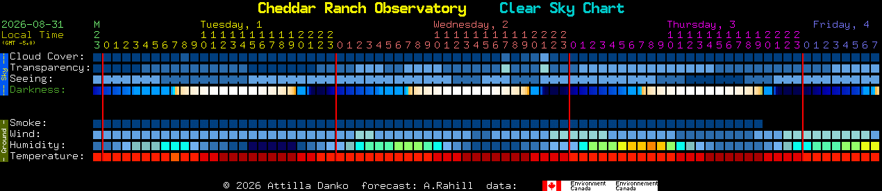 Source: Clear Sky Chart by Attilla Danko, cleardarksky.com · data from Canadian Meteorological Centre →
This all-sky feed is captured with a KT&C KPC-DNR700NHB DSP color CCD camera (600 TVL, NTSC, 3.6mm fisheye lens) under a Pro-Dome acrylic weatherdome, digitized through a USB video capture device and processed with Moonglow Technologies' All Sky Cam Uploader software.
Camera hardware donated by the 4 Domes Consortium.
This page is built on several independent projects, credited here with thanks:
All Sky Cam Uploader by Moonglow Technologies — camera capture, archiving, and upload.
VirtualSky.js by Stuart Lowe, originally developed at Las Cumbres Observatory — sky object overlay.
Regional cloud cover imagery via College of DuPage NEXLAB, sourced from NOAA GOES-East satellite data.
Clear Sky Chart by Attilla Danko (cleardarksky.com), using Canadian Meteorological Centre forecast data.
ImageMagick — image processing in the capture pipeline.
Typefaces Fraunces, IBM Plex Mono, and Inter via Google Fonts.
Page development and troubleshooting assistance from Claude (Anthropic).
Page maintained by quartermaster@okcastroclub.com